 Axiel Solutions
Code tool · Google Earth Engine
ORCAAH: Hilo Bay water quality from satellite imagery
A fork of NASA’s Optical Reef and Coastal Area Assessment (ORCAA) tool for Google Earth Engine, parameterized for clean water and health analyses of the Hilo Bay watershed.
What it does
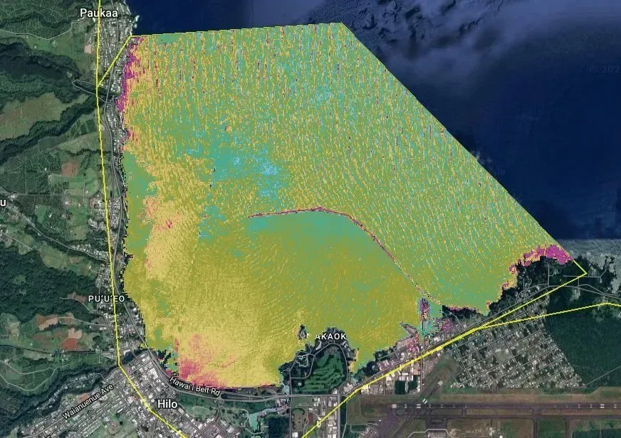
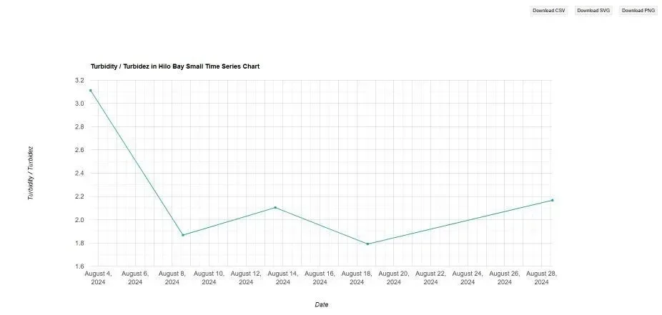
ORCAAH takes NASA’s ORCAA workflow, built to assess reefs and coastal waters from optical satellite imagery, and sets its parameters for the conditions of Hilo Bay and its watershed on Hawaiʻi Island. The result is a repeatable way to map water clarity and track turbidity over time from freely available imagery.
How it is used
The tool has been run during storm events since 2024, when runoff from the watershed carries sediment into the bay. Each run produces a mapped surface of the bay and time series for comparison between events.