Axiel Solutions

Portfolio

GIS projects

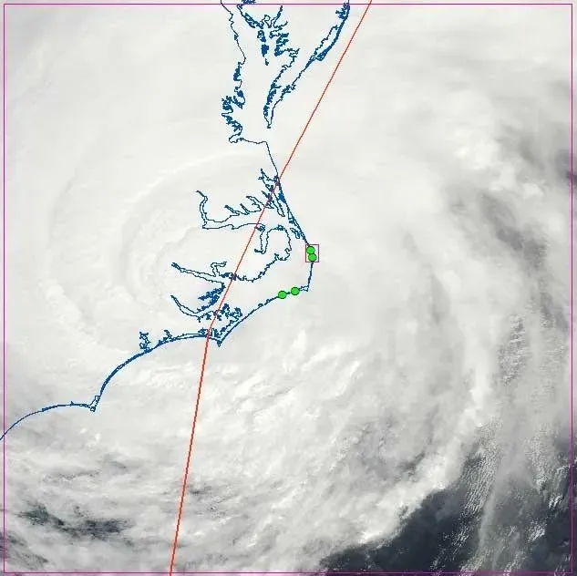
Satellite image of Hurricane Irene over the North Carolina coast with the storm track overlaid
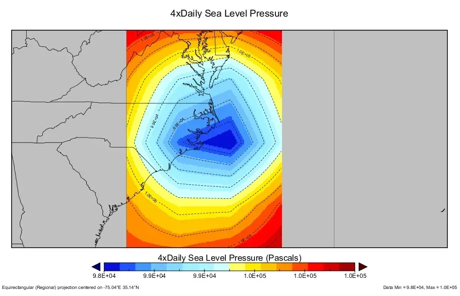
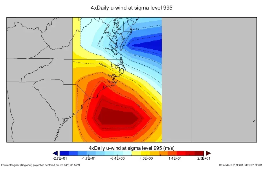
Map of NOAA reanalysis sea level pressure over the Mid-Atlantic during Hurricane Irene Map of NOAA reanalysis u-wind at sigma level 995 during Hurricane Irene

Earth, ocean, and atmospheric science

Hurricane Irene storm surge, sound side of the Outer Banks

Irene made landfall on North Carolina's Outer Banks on August 27, 2011. Surge on the sound side was far greater than on the ocean side and pushed flooding far upriver. This analysis combined standard GIS layers with NOAA multidimensional NetCDF earth observation data to identify the meteorological and oceanic drivers behind it.
Read the project summary

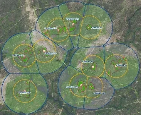
Aerial map of red-cockaded woodpecker cluster partitions with foraging buffers

Ecology · forestry · biology

Red-cockaded woodpecker habitat impact matrix

Matrix evaluations of RCW population viability and impact scenarios for potential infrastructure expansion on Fort Bragg and North Carolina Wildlife Resources Commission game lands.

Code tool · ETL automation

Permit GIS data conversion

An ETL tool in PowerShell, Python, and T‑SQL that runs weekly data conversion and GIS publication for a county's citizen self-service permit portal, back-office review portal, and mobile inspection app. It joins operational and utility GIS data with tax data, validates the result against a data hygiene matrix, and reformats it to a third-party schema for delivery as GIS services.

In continuous production since 2019

Read the project summary

Living deliverables

Production and collaborative work

Projects built for continuous updates, web delivery, or map books, produced with multiple stakeholders, or restricted from public release.

  • Caribbean Online Radiocarbon Database for Archaeologists (CORDA)
  • North Carolina Beach and Inlet Management Plan, geospatial component
  • Neuse Greenway master planning, geospatial component
  • LEDPA analyses for multi-state infrastructure expansion
  • DOT CAD/GIS integration for roadway and bridge maintenance
  • Corridor planning
  • Jurisdictional wetland delineations and mitigation bank modeling
  • Predictive modeling and spatial statistics for sensitive resource hotspots
  • Economic, social, and demographic analyses for emergency management
  • Data stewardship for continuous monitoring feeds: wells, species sightings, networks
  • Protected federal and state GIS databases, including SDSFIE structures

Writing and peer review

Technical writing

Whitepaper

SDSFIE and FGDC-compliant data management for DoD cultural and natural resources

A guide for DoD resource managers implementing legislatively compliant GIS and business data systems and answering open data and data call requests.

DoDI 8130.01 directs that all current and planned investments in IGI&S data, information, and IT conform to the DoD Business Enterprise Architecture and be visible, accessible, understandable, trusted, and interoperable throughout their lifecycles.

Compliance report

Archaeological inventory survey, Waikīkī, Honolulu

From the Historic Context section of a report prepared for permit review of a development project.

Hawaiian cultural landscapes can often be best described through significant Hawaiian place names, or wahi pana, and moʻolelo.

Peer-reviewed article

Intra-island stone tool source variability on Tutuila, American Samoa

XRF analysis of basalt adze samples that reassigns source locations with greater precision and refines models of exchange across Western Polynesia.